| Guide - Groundwaters in Hungary |  |
IMPORTANT INTERNATIONAL AND NATIONAL LEGISLATION ON GROUNDWATERS
International legislation
The Water Framework Directive of EU (Directive of the European Parliament and of the Council 2000/60/EC of 23 October 2000 establishing a framework for community action in the field of water policy)
The objective of the Directive is to establish a framework for the protection of waters, among them for the protection of groundwaters, which a.o
- "prevents further deterioration and protects and enhances the status of aquatic ecosystems and, with regard to their water needs, terrestrial ecosystems and wetlands directly depending on the aquatic ecosystems",
- "promotes sustainable water use based on a long-term protection of available water resources';
- "aims at enhanced protection and improvement of the aquatic environment inter alia through specific measures for the progressive reduction of discharges, emissions and losses of priority substances and the cessation or phasing-out of discharges, emissions and losses of the priority hazardous substances';
- "ensures the progressive reduction of pollution of groundwater and prevents its further pollution".
The Directive applies basically the river basin approach. However it should be taken into account that the borders of river basins (catchment areas) are adjusting to surface waters, groundwaters do not follow them completely, and that the national borders (among them the borders of EU) are frequently crossing the natural catchment areas. The Directive lays emphasis on the control of transboundary groundwater resources as well.
The Directive prescribes the setting of environmental objectives relating to groundwaters as well. The main issue is to maintain the balance of withdrawal and recharge and to prevent or reverse the deterioration of the status of groundwaters:
- as far as its quantity is concerned groundwater has a good status when level changes due to anthropogenic alterations do not cause changes of surface waters influencing terrestrial ecosystems and when they do not cause changes in the flow direction thus leading to the deterioration of water quality, - the chemical status of water is good when the concentrations of pollutants do not exceed the quality standards applicable under the relevant Community legislation and they do not result in any significant damage to terrestrial ecosystems, which depend directly or indirectly on groundwaters and when no extension of any pollution can be demonstrated.
To the implementation of the environmental objectives the Directive prescribes deadlines to be strictly kept and may be postponed to a limited extent only. The "good" chemical and ecological status of surface waters and the "good" quantitative and chemical status of groundwater shall be reached by the year 2015.
The provisions shall not be considered violated if they could not be implemented because of unforeseen or exceptional circumstances like the droughts in connection with groundwater levels in Hungary. Impacts should be studied also in these cases and all possible measure shall be taken to restore the original situation.
The Directive regulates the monitoring of the status of waters, among those that of groundwater as well. Observations shall be extended over all groundwaters, however those shall be made more frequently where the achievement of environmental objectives is doubtful and near the state borders as well. The primary objective is to provide information to the evaluation of the long-term changes brought about by natural processes and/or anthropogenic activities. The Directive calls for the monitoring in the form of periodic surveys, systematic observations at specific sites and special tests under exceptional circumstances.
The Directive prescribes to register the protected areas (among them those serving the protection of groundwaters) furthermore the identification of all bodies of water used for the abstraction of water intended for human consumption providing more than 10 m 3 a day or serving the water supply of a population more than 50 persons. Bodies of water providing more than 100 m 3 a day shall be monitored.
The Directive provides the characterisation of river basins (including also groundwaters). More detailed characterisation is required where the establishment of good status is difficult. River Basin Management Plans shall be prepared and reviewed regularly providing the ways of achieving the environmental objectives and the necessary measures. States shall report these and the results to the European Union at regular intervals.
The Directive orders the elaboration of action programmes to the mitigation of pressures and pollution of waters. With certain exceptions the Directive prohibits the activities involving the direct discharge of polluting substances into groundwaters.
The Directive contains numerous other provisions as well. The implementation of the provisions and measures shall be summed up in the River Basin Management Plans covering the area of the river basin and/or the relevant countries. The plans shall be revised in every six-year.
The transposition of the Directive and the implementation of the provisions shall be completed in Hungary by the same deadlines as in the member-states of the ED. A basic requirement of the implementation of the Directive is the implementation of other directives referred to in it.
As far as the protection of groundwaters is concerned two directives are of outstanding importance:
- the so-called Groundwater Protection Directive (80/68/EEC).
(Its Hungarian adaptation is the Government Decree No. 33/2000 (III. 17.) on some tasks concerning the activities influencing the quality of groundwaters)
- the so called Nitrate Directive (96/676/EEC)
(The Hungarian adaptation is the Government Decree No. 49/2001 (IV. 3.) on the protection of waters against the nitrate contamination of agricultural origin).
The Groundwater Protection Directive (80/68/EEC) deals with the protection of groundwater against hazardous substances. It classifies the hazardous substances into List I and List II depending on the level of danger caused by the relevant substances.
The Directive differentiates between the direct discharge into groundwater and the case when the polluting substances are reaching the groundwater percolating the unsaturated zone (indirect discharges). The Directive prohibits the direct discharge of the List I substances and prescribes that all activities with the indirect discharge of the List I substances and with the direct or indirect discharge of List II substances are requiring authority licensing. The license may be granted only if the preliminary tests have proved that the concentration of contaminants in groundwater would not exceed an inadmissible level. The license may be granted for limited period only and it has to be revised at least in every 4 year. The license shall define the conditions of the activity to be performed, measuring of the discharge and the monitoring of the impacts shall be prescribed (if the implementation of the latter is realistic). The measurements and observations shall be documented. The member-states are obliged to report on the activities covered by the Directive. The content of reports is regulated separately.
The Nitrate Directive (911676/EEC) covers the protection of waters against the pollution of agricultural origin. All waters and their catchment areas shall be declared sensitive against nitrate pollution where the nitrate content of the water already exceeds the 50 mg/I, or where it may exceed this value if the rules of "good agricultural practice" were not be followed. The rules of "good agricultural practice" are covering the installations of animal breeding, the storage of solid and liquid manure and the spreading of manure. The application of "good agricultural practice" is obligatory in the nitrate-sensitive areas. The total amount of nitrate spread with the manure shall not exceed the value of 170 kg/ha. The Directive prescribes the obligation of data reporting' as well.
Government Decree No. 74/2000 (V.31.) Korm. on the announcement of the Convention on the Protection and Sustainable Use of the Danube River done in Sofia on the 29th June 1994
The scope of the Convention announced by the Decree extends over. the Danube basin and the watercourses therein, however it defines the preservation, improvement and rational use of groundwater in the objectives and principles. It refers eminently to groundwater resources to be protected on a long term and the existing and future protection zones important in the future drinking water supply, to the prevention of deterioration of groundwater resources (caused mainly by nitrates, herbicides, pesticides and other harmful substances).
National legislation
Annex 1 lists the most important legal regulations referring to groundwater. Also a short summary of the most significant regulations can be found below.
Act LIII of 1995 on the general rules of environmental protection
This Act contains the basic rules of the protection of waters and those of groundwater among them. It prescribes the general rules of the protection of environmental components and those of groundwaters among them. It defines among others the basic principles of protection (precaution, prevention, remediation, responsibility, cooperation, gathering and providing information, and publicity). It declares the general requirement of the consistent protection of the environmental components on one hand, and contains the basic rules of water protection on the other.
As far as groundwaters are concerned, consistent protection refers to the consideration of the interactions with surface waters on one hand and entails the harmonisation of the protection both of groundwater and the geological medium as well (topsoil included).
The Act declares that when using the environment "waters shall remain as a factor of the landscape, the conditions necessary for the survival of the aquatic and riparian flora and fauna as well; the quantity and quality conditions ensuring the potential use of water shall not deteriorate." By comparison of the general level of quality protection (provided mainly the Government Decree No. 33/2000 (III. 17.) Korm.) the water resources for drinking water supply and those serving the utilisation of mineral and medicinal waters should be specially protected (The special rules of such resources are defined by the Government Decree No. 123/1997. (VII. 18.».
The Act prescribes that in the framework of the state responsibilities for environmental protection, the quantity and quality objectives (target state) of the environmental components shall be defined among others.
In the course of the elaboration of the National Programme of Environmental Protection adopted by the Hungarian Parliament, also the target state (quality and quantity objectives) of groundwater for the years 1997 to 2002 has been defined.
The quality objective (target value) for groundwater means that the quality of groundwaters of strategic significance shall come near the quality of waters not influenced directly by human activities, within 50 years in the whole country.
This requirement does not relate to the known areas of permanent pollution, encompassed, being monitored and entered into the land registry, and to the delimited immediate surroundings of localities (delimited by a monitoring system).
The quantity objective (target value) of groundwater has the meaning that the tasks of outstanding importance are as follow:
- hampering the decrease of the level (pressure head) of groundwater, the promotion of its regeneration, the recovery of the water household in the endangered regions,
- developing the equilibrium of abstraction and recharge so that the level of near-surface water (shallow groundwater and open karstic waters) do not fall below the long term quasi-natural average, except in the immediate neighbourhoods of the abstractions,
- do not ensue unfavourable change of water quality because of the new hydraulic conditions resulting from the abstraction of water.
The Act prescribes the establishment of environmental requirements to the control of discharges and the quality protection of recipients. These may be among others the various limit values.
The Act differentiates several kinds of licensing processes as they follow:
- environmental license based on environmental impact assessment,
- uniform license to the use of the environment,
- environmental license of operation based on environmental audit.
Beyond these the environmental authority takes its position through the issue of a decision or declaring its position as an expert authority in cases defined by a separate legal rule. In the case of groundwater use or direct discharge therein, the latter is the general, linked to the process of water licensing.
Act LVII of 1995 on Water Management
The scope of the Act extends to the subsurface waters (groundwaters) too, to the natural aquifers of groundwater, to the facilities and activities, which can change the runoff and flow regimes, the quantity and quality of waters or the aquifers of groundwater. According to the Act efforts shall be made for the preservation of alternatives for water utilisation by regularly checking the availability of natural waters for utilisation, by preventing water pollution, by constructing and operating hydraulic facilities serving the conservation or training of waters and by preventing, reducing and eliminating damage to water quality, which hinders water use. Subsurface waters may only be utilised to an extent that the balance between water withdrawal and recharge shall be maintained without any adverse effect on the quality of such waters.
The Act lists among the tasks under state responsibilities (relating also to groundwater) the elaboration of the national conception of water management, the carrying out of the water management tasks which arise from international co-operation, designation of possible water withdrawal areas as being drinking water sources to be developed for water withdrawal in the long run and the preservation of the water resources of such developed supplies in a usable condition, carrying out the various regulatory and authorities' tasks. State is responsible also for the ordering the collection of data required for water management, for carrying out and ordering the hydrographical activities and for making inventories of the quantities and qualities of water resources.
The Act lists municipal tasks as well, especially in the field of drinking water supply as far as groundwaters are concerned. In connection with tasks of regional significance Regional Water Management Councils shall be established.
According to the Act, groundwaters and the natural aquifers thereof shall be owned exclusively by the state however those who have acquired rights to utilise the water resources, shall keep them safe in proportion to the extent of utilisation. In view of the protection of the quantity and quality of available water resources, the water demand may be primarily met from the water resources not yet committed for water use. In the order of satisfying water demands firsts are the water uses aimed at drinking, public health and emergency responses to disasters followed by the demands of activities serving directly the population, livestock watering, fish farming, nature conservation, economic and other uses. When using mineral, thermal and medicinal water resources, the uses by therapeutics and convalescence recreation shall be preferred. If the quantity of available water is reduced for natural or other insurmountable reasons, water use may be restricted without compensation, except water use for subsistence, in the order mentioned above.
A water license shall be required for carrying out operations on waters or for the construction, reconstruction and decommissioning of hydraulic facilities (establishing permit) furthermore for the commissioning and operation thereof, as well as for all water uses (operating permit) (see: Government Decree No. 72/1996 (V.22.) Korm. and Decree No. 18/1996 (VI.13.) KHVM of the Minister of Transport Communication and Water Management). In the field of groundwater this refers mainly to production wells.
According to the most recent regulations the water license is in force until definite deadline, in accordance with the EU-regulations.
The user is obliged to pay a water resource fee for the amount of water committed in the permit or used without permit [see: Decree No.II/1999 (III.11.) KHVM of the Minister of Transport, Communication and Water Management, and Decree No. 43/1999 (XII.26.) KHVM of the Minister of Transport, Communication and Water Management, furthermore the yearly acts on the national budgets].
Waters serving or designated for drinking water supply and for utilisation as mineral and medicinal water shall be kept strictly protected and safeguarded, by developing and maintaining protective blocks and protection areas of the water withdrawal to the extent specified in separate legal rules [see: Government Decree No. 123/1997 (VII.18.) Korm]. In the interest of the protection of drinking water resources to be developed for water withdrawal in the long run or of water resources already committed with preliminary water licenses the water authority may order the restriction of ownership and use in accordance with a separate legal regulation.
Government Decree No. 72/1996 (V.22.) Korm. on the implementation of authority powers in water management
The Decree, authorised by the Water Act regulates the powers of the water administration (the competent District Water Authority on the 1" instance, the National Water Authority as 2nd instance authority), of the municipal clerks and the implementation of authority powers in water management. The water permit required to operations on water and to the construction of hydraulic facilities (in connection with groundwater: wells and the captures of springs) shall be acquired by the owner.
Prior to the process the owner or the consultant commissioned by the former may apply for the planning water license (license in principle, preliminary permit) in which the variants most suitable for the implementation of the water management objective and their preconditions, the possible site and technology of the acquisition and utilisation of water and the disposal of used water, the quantity of water exploitable together with its mean and extreme values furthermore the limit values of the amount and quality of used water to be disposed, and the environmental and nature conservation requirements for the planning, construction and operation shall be fixed.
Permit for construction (construction water permit) relating to water uses may be granted only if simultaneously the collection, treatment and disposal of wastewater produced as a consequence of the utilisation is solved in compliance with the environmental rules.
An operating water permit is required to the execution of water use and to the operation of hydraulic facilities. It shall prescribe among others the conditions of operation, the rights and obligations in connection with it, the self-control and the date of expiry. For public hydraulic facilities the permit prescribes the elaboration and execution of the Rules of Operation. In the case of hydraulic facilities on groundwater (mainly wells) a documentation defined by a separate legal regulation shall be attached (Hydrogeological Report).
Decree No. 18/1996 (VI.13.) KHVM of the Minister of Transport, Communication and Water Management on the application form and its annexes to be submitted for granting the water permit
The regulation defines the requirements on the contents of the application for a water permit and of the documents to be submitted for licensing. In groundwater management the Decree gives regulation on acquisition of water, on the facilities of water abstraction (wells, springs), protective blocks and protection areas, in the latter cases to be interpreted together with the Government Decree No 123/1997 (VII.18.) Korm.
Government Decree No. 123/1997 (VII.18.) Korm. on the protection of the actual and perspective sources and the engineering facilities of drinking water supply
The scope of the Decree extends to the sources of water serving the drinking water supply of the population, the utilisation of mineral- and medicinal waters, regardless whether actually exploited, committed or designated for future use, further to the facilities serving the treatment, storage and distribution of water for such uses, and which supply water to at least 50 persons on a daily average. These sources and facilities of water supply shall be provided with special protection in the interest of which protective blocks, protection areas shall be designated.
The source of water supply (resources developed for water withdrawal) is defined by the Water Act as it follows: it is "an area or subsurface part of the space, which is used or designated for utilisation by intake works, as well as the water available for withdrawal there from, together with the existing and planned water taking facilities"
The protective block and the protection area shall be divided into inner, outer and hydrogeological protection zones. The dimensioning is based on the travel times calculated from the subsurface flow velocity:
- 20 days travel time (or a radius of 10 m as a minimum) belongs to the inner protection zone (assuring technical protection), half a year (or a radius of 100 m as a minimum) belongs to the outer protection zone,
- part "A" of the hydrological protection zone is defined by 5 years travel time,
- part "B" is defined by 50 years,
- the outer border of part "C" is coinciding with the border of the whole recharge area (being designated exceptionally only).
The Decree prescribes various restrictions in the various zones on the potential pollution sources and polluting activities:
- in the inner zone practically any activity not directed towards the operation of the facilities is prohibited, the outer zone keeps the degradable contaminants away
- the hydrogeological protection zones are protecting against the substances non-degradable within the travel time.
Restrictions are more stringent for newly launched activities, running activities may be allowed under some stipulations. The Decree prescribes several terms conditionally for both cases, depending on the outcomes of the environmental audit. The restrictions are relating to construction, recreation, industry, transport, mining and drilling activities. (In "B" part of the hydrogeological protection zone complete prohibition relates only to activities with strongly toxic or radioactive substances, to the infiltration of industrial wastewaters and to the release of transported wastewaters.) In zone "A" of more limited extension and further on towards the abstraction facilities one can find more and more severe restrictions.
The Decree contains also rules of procedure on the documentation of safeguarding a particular source of drinking water supply, on the designation of protection zones and on keeping drinking water sources safe.
Joint Instruction No. 8001/2000 (Kö.Vi.Ért.5) KöViM-KöM of the Minister of Transport, Communication and Water Management, and of the Minister of Environmental Protection on the perspective sources of drinking water supply
Authorized by the Water Act and with respect to the Government Decree No. 123/1997 (VII.18.) the ministers declared the potential abstraction areas listed in the Annex of the Instruction as perspective sources of drinking water supply.
Decree No. 43/1999 (XII.26) KHVM of the Minister of Transport, Communication and Water Management on the calculation of water resource fee
The Decree, referring to the Water Act, obliges also the users of groundwater to pay the water resource fee. The basic fee, defined by the Act on the State Budget yearly, (HUF 1,80/m 3 for the year 2001 and HUF 1,90/m 3 for 2002) is multiplied by factors depending on the particular water use and on the water management situation of the appropriate region. The multiplier factors concerning groundwater-uses can be found in Table 1.
Decree No. 11/1999 (III.11.) KHVM of the Minister of Transport, Communication and Water Management on the appropriation of the Water Earmarked Financial Facility (VICE)
The water resource fee is the input to the Water Earmarked Financial Facility. Among the objectives of the Facility the Decree lists a.o. the protection of drinking water supply, the enhancement of its safety, the exploration of water resources, the development of hydro graphical activities, and a contribution to the financial sources of water management research
Multipliers to the water resource fee
Table 1
|
Type of water |
Character of water uses |
|
Groundwater |
Medicinal purpose |
Public purpose |
Economic purpose |
|
Drinking water |
Animal |
|
Irrigation |
farming |
Baths |
Other |
|
medicinal water |
registered |
1,0 |
5,0 |
5,0 |
|
|
5,0 |
10,0 |
|
thermal water |
>or=30 °C |
1,0 |
1,0 |
3,0 |
|
|
3,0 |
7,5 |
|
karstic water |
Class I |
|
1,2 |
3,0 |
|
4,0 |
3,0 |
6,0 |
|
Class II |
1,0 |
2,0 |
3,0 |
2,0 |
5,0 |
|
|
Class III |
0,5 |
1,0 |
2,0 |
1,0 |
4,0 |
|
deep ground water |
Class I |
|
1,0 |
3,0 |
4,0 |
3,5 |
3,0 |
5,0 |
|
Class II |
0,8 |
2,0 |
3,0 |
2,0 |
2,0 |
4,0 |
|
Class III |
0,5 |
1,0 |
2,0 |
1,0 |
1,0 |
2,0 |
|
bank-filtered water |
Class I |
|
1,0 |
1,5 |
2,0 |
1,5 |
1,5 |
3,0 |
|
Class II |
0,7 |
1,1 |
1,5 |
1,1 |
1,1 |
2,0 |
|
Class III |
0,5 |
1,0 |
1,0 |
1,0 |
1,0 |
1,5 |
|
Class 1 |
Water of quality not exceeding the tolerable levels of the standard. |
|
Class 2 |
Water of quality exceeding the tolerable levels of the standard, which may be purificated to drinking water quality with standard treatment technology economically. |
|
Class 3 |
Water of quality exceeding the tolerable levels of the standard, which cannot be purificated to drinking water quality with standard economical treatment technology economically. |
and development. These objectives are relating also to groundwater and/or are linked to it indirectly. The Decree lists among the objectives directly serving the protection of groundwater the putting into safety the developed sources of drinking water supply and the protection of the committed ones. As provided by the Decree, the Minister responsible for water management announces a call for applications with the actual conditions in each year.
Decree No. 28/2001 (XII. 23.) KöM of the Minister of Environment on the detailed rules of the use, recording and superintending the Environmental Protection Fund
Indent 0) Section 49 of the several times modified Act XXXVIII of 1992 on the State Finances and its enacting clauses are providing rules for the Environmental Protection Fund (EPF)*. The use of KAC and the rules of its operation are regulated by the order of the Minister of Environment (Order No 28/2001 (XII. 23.) KöM) and his instruction (Instruction No. 25/2001 (K.Ért. 2002/2) KöM on the modification of Instruction No. 4/2001 (K.Ért.4.) on the Rules of Operation of the Environmental Protection Fund).
According to the legal regulations the Ministry of Environment circulates the calls for applications for KAC by the 28th of February at the latest, each year. The Inter-ministerial Commission consisting of the designated representatives of the
* EPF = KAC in Hungarian
competent ministries and of the NGOs for environmental protection and nature conservation has a significant role in the evaluation of the applications.
The protection and improvement of soil and the groundwater has a predominant position among the objectives of the National Programme of Environmental Protection. The protection of the geological media (the soil a part of which is) is a significant task because of its inseparable link to groundwater.
In this spirit also KAC pays a predominant attention to the protection of groundwater and soil and to the remediation of the existing damages.
One can find the following investments among the supported items since several years:
- environment-friendly investments of thermal water (t >30 o c) uses and those of lukewarm (t
= 25-30 o C) mineral and medicinal waters,
- development of technologies stopping the pollution load of groundwater and soil,
- all the remediation investments.
A new item is the financial support of smaller investments of local significance serving the protection of soil and groundwater in addition to the assistance given to the preparation of the Municipal Environmental Remediation Sub-programmes.
Government Decree No. 132/1997 (VII.24.) Korm. on the tasks in connection with the elimination of damages to water quality
The Decree regulating the activity oriented towards the prevention, averting or moderating the damages resulting from the excessive contamination of water due to unforeseeable events or unknown reason relates also to groundwater (especially the accidental pollutions of shallow groundwater are belonging to this item).
Act LIII of 1996 on nature conservation
The Act relates also to groundwater: each spring and sinkhole are under protection.
In the application of the Act spring means any natural outflow of water from the earth provided that its discharge exceeds 5 l/min, even if it gets temporarily dry. Sinkhole means any cleft in karsts which conducts a permanent or temporary watercourse underground.
In the framework of the general protection of natural geological values the Act prohibits the pollution or unlawful modification of karstic rocks or the karstic water below the uncovered karstic surfaces. Through this and with the protection of habitats, landscapes, lakes, watercourses, swamps, geological formations and caves the Act serves also the protection of groundwater indirectly.
Government Decree No. 33/2000. (111.17.) Korm. on activities that affect the quality of groundwater
The objective of the Decree is to avoid the pressures on groundwater as far as possible, to prevent the contamination of groundwater and of the geological medium, the reduction and elimination of contamination exceeding the limit value.
The Decree declares that activities with the use of hazardous substances may be performed only with preventive environmental measures. In the case of disposal, storage and use of substances this means the development of proper insulation system.
Both to the disposal of hazardous and non-hazardous or inert substances, the relating orders are coming from the Act No. XLIII of 2000 on Waste Management. Requirements included by them shall be applied taking the Government Decree 33/2000. (III. 17.) into account.
The same principle shall be applied when establishing storage sites for inflammable fluids or in connection with the disposal of other hazardous substances if any separate legal regulation is in force relating to them.
In the case of activities not regulated the above way the installations shall be planned applying the provisions and instructions of the various standards and guides so, as the installations do not cause any unacceptable load on the geological medium and groundwater.
The Decree prohibits the direct discharge of hazardous substances or of substances containing them or of those the degradation of which results in hazardous substances into groundwater.
Exceptionally and under strictly defined conditions the Decree allows the re-injection of water abstracted for geothermal purposes or in the course of mining and engineering activities, furthermore the re-injection for scientific purposes and the groundwater recharge. However in these cases the best available technologies shall be applied.
Indirect discharge may be permitted if it does not lead to the contamination of the geological medium and groundwater exceeding the limit value, and if the activity is performed under controlled conditions. The Joint Decree No. 10/2000 (VI. 2.) KöM-EüM-FVM-KHVM contains the limit values for the geological formation and for groundwater separately
The Decree distinguishes the following values:
- Background concentration (A): Representative value, typical concentration of a particular substance reflecting natural, or close to natural conditions in the groundwater or in the soil;
- Demonstrated background concentration (Ab): Concentration representative of a particular area as the resultant of natural conditions and a load via a component of the environment other than groundwater and the geological medium.
This is to be applied in lieu of the background concentration (A);
- Pollution limit value (B): Concentration of hazardous substances set with due regard in the case of groundwater to the requirements of drinking quality and the aquatic ecosystems, in the case of the geological medium to the multi functionality and the sensitivity of groundwater to pollution;
- Intervention pollution limit value (Ci) concentration of the hazardous substances depending on the sensitivity of the affected area; when it
is exceeded, the environmental inspectorate is obliged to intervene;
- Remediation limit value of pollution (D): concentration defined by authority decision, to be reached as the result of remediation;
- Specific pollution limit value (E): the pollution limit value determined in lieu of the pollution limit value (B) in an authority decision supported by a quantitative risk assessment for the particular situation, taking the actual land use into consideration, where the activity had started before the Environmental Act has entered into force.
The intervention pollution limit values in the joint ministerial decree (see later) are different depending on the sensitivity of the area against pollution, given in a separate Annex (Figure 17).
When determining the sensitivity against pollution mainly the protection of groundwater was taken into account, however the sensitive areas are including also the strips along the shorelines of lakes and the areas significant from the point of view of nature conservation (natural waters' of international significance, national parks, prominently protected nature conservation areas, biosphere sanctuaries). From the point of view of groundwater protection as predominantly sensitive areas are considered the open karstic areas further the various protection zones designated or under designation of actual and perspective sources of drinking water supply, and those of abstractions serving the utilisation of mineral and medicinal waters. Among the sensitive areas the karstic formations situated within the depth of 100 m and the main clastic aquifers in the basin-like areas at the depth less than 50 to 100_m are appearing. The rest of areas are qualified as moderately sensitive ones. The classification may be specified through local sensitivity studies.
The Decree declares that the quantity of the discharges shall be measured, their composition shall be analysed and the results shall be documented. Where the danger of the pollution of groundwater or geological medium exists, there the changes of concentrations in the environment shall be monitored.
The Decree prescribes a registration system of the activities, discharges under the power thereof and of the state of the relevant geological medium. The minister of environment publishes the data sheets, filling instructions and the annexes required by the Environmental Registration System on Groundwater and the Geological Medium (FAVI). At the time being the Instruction No. 8001/2001. (K. Ért. 2002/2) is in force.
The Decree declares that the person is responsible for the pollution, damage who performed the activity (the operator) or who assumes the liability for the environmental damage. For the contaminations falling under state responsibilities the organization competent according to the work-sharing pattern of the administration is liable. The Decree covers also the cases when the operator of the activity is unknown or dissolved without a legal successor.
The implementation of remedial measures is being taken in the framework of the National Environmental Remediation Programme (OKKP).
The objective of OKKP - among others is the registration of pollution sources and polluted areas within the KÁRINFO system, and the reduction of pollution by authority interventions to an acceptable level.
The Decree contains rules of procedure to the notification of contaminations and pollution sources, to the licensing procedure of activities and to the remediation. The remediation includes the recognition of contamination (survey), the interventions aiming at the decrease of risk and of contamination (engineering measures) and the post-project monitoring of the changes of the environment covering the whole process of remediation.
In its annexes the Decree contains among others - the list of the hazardous substances according to the Appendix of Directive No. 80/68/EEC, the substantial requirements of the permits and other documents and aid to the calculation of groundwater pollution fine.
Joint Decree No. 10/2000 (VI.2.) KöM-EüM-FVM-KHVM of the Ministers of Environment, of Public Health, Agriculture and Regional Development and of Transport, Communication and Water Management on the limit values required to the quality protection of groundwater and of the geological media
Being in connection with the Governmental Decree No. 33/2000 (III.17.) Korm. the Decree sets the values of background concentration (as an information), those of pollution limit value, and of the intervention pollution limit value separately for the geological medium and for the groundwater as well (Annex 3). The Decree lists also the standards to be applied as well.
Government Decree No. 20/2001 (II.14.) Korm. on environmental impact assessment
The Decree represents the national regulation in harmony with the so-called EIA-Directive of the European Communities.
Prior to the commencement of activities listed in Annex 1 of the Decree, the applicant has to report to the Environmental Inspectorate the intention of commencement, the preliminary environmental impact assessment attached.
Section A of Annex 1 lists the activities in the case of which the implementation of environmental impact assessment is obligatory. In other cases of activities or significant alterations (of the environment) listed in Section B, the environmental impact assessment shall be implemented depending on the decision of the Environmental Inspectorate.
A certain part of the activities listed in Annex 1 relates directly to groundwater (e.g. use of groundwater, re-injection into groundwater) and to the protection zones of groundwater abstraction areas. These are introduced by Annex 2 in details.
The obligation of environmental impact assessment also in the case of the rest of activities listed in Annex 1 promotes in each case the protection of groundwater and the soil indirectly.
Government Decree No. 193/2001 (X. 9) Korm. on the detailed rules of uniform licensing process of the use of environment
This Decree is a national regulation in harmony with the so-called IPPC Directive of the European Communities. The operators of activities with significant environmental impact listed in the Annex of the Decree shall possess an environmental license, new activities may be commenced only upon such a license. New activities from their commencement, activities commenced earlier, after 31.10.2007 have to be in compliance with the requirements of the best available technologies.
All these provisions are aiming at the smaller load on the geological media and on groundwater in the future.
Decree No. 74/1999(XII.25.) EüM of the Minister of Public Health on the natural curative factors
The scope of the Decree extends to the curative activities utilising natural medicinal factors, to medicinal baths, climatic health institutions, and to those producing and trading natural mineral water, medicinal water and curative mud.
From the point of view of groundwater the process of qualification of mineral waters and medicinal waters is important.
The Decree accepts as qualified (registered) mineral water the waters originating from aquifers protected by nature or through appropriate measures, being naturally clean with nearly steady composition and dissolved solid content, and harmless to human health from microbiological and chemical aspect in the actual form of use and
- if the total dissolved solid content is more than 1000 mg/l,
- or the total dissolved solid mineral content is 500 to 1000 mg/l and the water contains one of the active biological substances listed in the Decree, depending on the way of use (internal or external) in a concentration higher than specified.
The medicinal water is a natural mineral water of proved curative effect. The curative effect shall be proved by medical tests. The medicinal water shall comply with the requirements of mineral water in each case.
The Decree makes difference between external (as bathwater) and internal use (with the purpose of drinking, bottling, inhalation). The Decree regulates also the process of how to declare a health resort, a medicinal bath or curative mud as a registered one.
Act XLVIII of 1993 on mining
Almost all kinds of mining activity may affect groundwater. The Act declares that in this respect the environmental and water management regulations are decisive:
- if the exploitation of geothermal energy requires the abstraction of groundwater, the Mining Authority takes part in the process of granting the water permit as intervening authority,
- the technical plan of the mining activity shall be elaborated so as to assure the possible prevention or reduction of environmental-natural damages (in certain cases damages are appearing in groundwater or they are transmitted by them).
- the mining company may use the water exploited in the interest of the security of the mining activity for its operational purposes. For the utilisation of the exploited water the rules of environmental protection and water management are definitive,
- the re-injection of fluids brought to the surface by the mining company requires environmental impact assessment and shall have the environmental license prior to the application for the water permit,
- the Mining Authority participates in the water licensing process on bringing the groundwater to the surface,
- as far as closing up of the mines is concerned, the Act specifies that the underground spaces shall be abandoned in a state which is not endangering the environment or the ground surface (this is important particularly with a view to the protection of groundwater
).
Government Decree No. 203/1998 (XII.19.) Korm. on the execution of the Act XLVIII of 1993 on mining
The Decree specifies that the technical description of the mining site shall define the impact on groundwater.
On every kind of mining activities environmental impact assessment shall be performed, the existence of which is a precondition to the technical plan of mining operations. The technical plan of mining operations has to deal with the impacts of mining activity on the environment, with the measures on the prevention and reduction of harmful environmental impacts, the monitoring of the impacts and with the way of establishing and operating the monitoring sites. This relates also to the protection of groundwater.
Government Decree No. 239/2000 (XII.23.) Korm. on the rights and obligations with reference to the utilisation of gravel- and sand-pit pools
The definition of the pit-pool in the Decree is as follows: stagnant body of water developed from groundwater resources as a result of surface- or underground mining after having the covering layer removed, which remains after stopping the mining activity and the bed of which is a depression excavated in the course of mining activities.
As provided by the Decree a water permit is required to the maintenance, use, and utilisation of the pool as a water resource. The pollution of the water of the pools is prohibited, especially their use as recipient of waste water as well as any use endangering the quality of their water because of their close contact with groundwater resources.
Government Decree No. 49/2001 (IV. 3.) Korm. on the protection of waters against nitrate pollution of agricultural origin
The Decree designates the areas sensitive against nitrate pollution from the point of view of the protection of both surface and groundwater. It has declared as sensitive the catchment areas of the big lakes (Lake Fertő, Lake Balaton and Lake Velence), further the catchment areas of every drinking water storage reservoir and a strip as wide as 300 m around the pit pools.
From the point of view of groundwater protection the highly sensitive areas of groundwater protection as defined by the Government Decree No. 33/2000 (III. 17.) Korm. shall be considered nitrate sensitive, furthermore all the areas where the groundwater - presumably as a consequence of agricultural activities - contains already more than 25 mg/l nitrate. The nitrate-sensitive areas can be observed in (Figure 19).
The Decree lists the areas according to the relevant localities. The nitrate-sensitive areas and the list of the relevant localities can be found also in the home page of the Ministry of Environment (www.kvvm.hu).
In the nitrate-sensitive areas the requirements of good agricultural practice shall be fulfilled as regulated in the Annex of the Decree. Those who are running agricultural activities shall keep a register on the amount of manure coming into being and stored in the animal farm and on the disposal thereof according to the data-sheet attached to the Decree. Based upon the register the data shall be reported to the soil protection authority.
The nitrate content of waters shall be surveyed every four year and based upon the results a proposal shall be submitted to the government on the possibly necessary amendments both of the designation of nitrate-sensitive areas and of the rules of good agricultural practice.
Government Decree No. 50/2001 (IV. 3.) Korm. on the rules of use and handling of waste waters and sludge in agriculture
The objective of the Decree is to regulate the transport of treated municipal wastewater and sludge to the agricultural areas, the agricultural usability of liquid municipal wastes included.
The provisions of the Decree are based among others - on the presumption that complying with the limit values specified to the loading of soil, the groundwater would not be contaminated. The requirements on soils are in compliance with the contamination limit value (B) set for the geological formations in the Joint Decree No. 10/2000 (VI. 2.) KöM-EüM-FVM-KHVM.
On the basis of the Act LV on arable land the Decree provides for licensing the performance of activities. Soil and groundwater tests are required to the pedological expert opinion and to the documentation to be submitted to the expert authorities.
The Decree complies also with the Government Decree No. 49/2001 (IV. 3.) Korm.
The total annual amount of nitrogen transported with the wastewater and sludge to the farmland may not exceed the 170-kg/ha value, organic manure included.
If for any reason the level of hazardous substances in the soil or groundwater exceeds the tolerable level (the contamination level (B) then the situation shall be investigated according to the Government Decree 33/2000 (III. 17.) Korm. resp. the remediation shall be commenced.
REVIEW OF INFORMATION, GROUNDWATER DATABASES AND THEIR ACCESSIBILITY
Major part of information on groundwater is the result of the hydrometric activity. Decree No. 22/1998 (XI.16) KHVM of the Minister of Transport, Communication and Water on the hydrographical activities of the water organisation regulates the central and regional tasks relating to the exploration, assessment, evaluation and forecast of quantity- and quality characteristics of surface- and groundwater. Among others it deals with the operation of hydrographical observation network, with the data transmission of water users and other organisations, the periodic state-assessments, further with the transfer, storage and communication of data.
Most of the information on groundwater is contained by the hydrogeological reports compiled on each well and by the National Cadastre of Wells containing data extracted from these reports.
One can find the following data in the well reports:
- serial number in the Cadastre (numbered continuously, making difference between the inner and outer zones in each locality),- locality, county, address,
- purpose of water abstraction, no. of construction permit, registration number, name of the competent District Water Authority,
- no. of the relevant cartographic sheet, national cartographic coordinates,
- depth of the cased section of the well, maximum depth of the borehole, - drilling technology, type and no. of drilling rig,
- detailed description of the penetrated layers (from m to m) on the basis of sampling and geophysical log,
- casing and screening of the completed well (diameter, the material of casing and screens),
- temperature of abstracted water, bottom-hole temperature,
- data of other operations,
- attachments (general and detailed map of the site, flow-curve, flow-test, recovery test, gas/water proportion, water chemistry, geological and technical log of the well, diagrams of geophysical tests).
The published cadastre prepared yearly from the data of the well reports contains the following:
- locality, no. in the Cadastre, name of the well, the year of completion, registration number,
- altitude of the site above sea level, national coordinates,
- depth, casing (diameter, depth), screen (depth, type),
- age and type of the aquifer,
- depth to the static level and to the drawdown, yield, specific yield,
- temperature of water at the head and at the bottom, depth of measuring,
- methane content,
- water chemistry (Na+K, Ca, Mg, Fe, Mn, As, NH", NO", NO", Cl, SO", total salt content, pH, total hardness, alkalinity, specific conductivity, O2 consumption.
The digital data volume of the Groundwater Resources Atlas linked to GIS, is refreshed yearly. It contains the data of the withdrawals of the operating, monitoring and reserve wells as they follow:
- data of production facilities at the date of completion and the volume produced in the particular year,
- important basic data of the above facilities as grouped in the water licenses and the producible volume contained by the license.
Data of operation (static and operational levels of wells and springs, data of production, results of water quality analyses) are forwarded by the operators of public water facilities and other operators designated by the competent District Water Authority to the regional and central data archives.
The following basic networks are for the monitoring of the quantity and quality changes of groundwater:
The basic network for shallow and deep groundwater level observations is operated by the state water- and geological organizations for a long time. The network for shallow groundwater level observation developed since the 30s extends to the plain areas and contains 1582 observation wells. The monitoring network observing the karstic water levels, containing 248 stations at the time being, has been developed since the 50s mainly in the Transdanubian Range mostly linked to the mining activities. The water level observation network on deep groundwater has been developed since the middle of the 70s utilising abandoned production wells for the most part; 384 such wells are being observed at the present time. Also the springs that are not connected to water supply systems are observed by the state water organization. The monitoring network of springs is recording the yield of 49 springs at the time being. The proportion of automatic recorders is continuously increasing in the networks.
The Basic Water Quality Network on Groundwaters is in operation since the mid-80s. At the beginning 1 to 12 samples were taken per year from about 600 production wells and springs, and the results were transmitted to the central archives. This network is based primarily on a part of water quality data originating from the collection of operational data (see above), therefore it does not comply with the requirements of a national basic water quality monitoring network. Primarily the water quality-monitoring network developed explicitly on the more vulnerable shallow and deep groundwaters is lacking. Such networks have been developed only in particular regions (in the Szigetköz and the perspective abstraction areas) and the environmental organs started to develop such networks on regional scale in our days (Duna-Tisza Region).
The information listed above can be found in the Central Hydrographical Archives (Budapest, IX. Kvassay Jenő út 1. Building K 2 nd floor) operated by VITUKI Plc. commissioned by the National Water Authority (NWA), (business hours: 09 h -14 h on workdays; free access to the data allowed, copy of paper sheets may be claimed on cost price). The maps belonging to the National Cadastre of Wells on the scale 1:25 000 displaying the well sites can be found also here. The Hydrographical Yearbook published by VITUKI Plc. commissioned by NWA contains the data of the basic hydrographical network. Data of groundwater uses of the year and groundwater levels measured in a network operated by the Geological Institute of Hungary can be found in a CD attached to the Yearbook.
In the Central Hydrographical Archives the data of the Basic Hydrographical Network can be found in digital form as well (charge for providing data in standard format is prescribed by NW A, if other format is required, charge is optional). The digital data volume of the Well Cadastre should yet be put into the proper order. In the early 90s a great part of the data was put into the digital database of the Hydrogeological Information System (Vizföldtani Információs Rendszer VIFIR), however it was not maintained continuously. Nevertheless this is not scheduled already because all the hydrological data will be put into the Hungarian Hydrological Data-Base (Magyar Hidrológiai Adatbázis - MAHAB) and into the National Basic-Data Management Subsystem (Országos Törzsadatkezelő Alrendszer - OTAR) in the framework of the ongoing development of Water Management Information System (Vizügyi Információ Rendszer VIZIR). Until its completion the digital data provision is implemented in a temporary way. The GIS materials of the Groundwater Resources Atlas readable in ArcView format, usable for those possessin the proper hardware, software and entitlement to use the OTAB master-map, and the data-volume of the year relating to the objects or groups of objects may be claimed also at the Hydrological Institute of VITUKI Plc.
To these are connected the sensitivity maps of the relevant areas and localities elaborated according to Annex 2/1 of the Government Decree No. 33/2000 (III. 17.). This set of sensitivity maps and the list of localities belonging to them can be observed on the homepage of the Ministry of Environment (www.kvvm.hu) The maps of scale 1:100000 in Arc-View format displaying the sensitivity of the areas and localities can be found on CD at the environmental inspectorates. More recent variations in connection with this can be found in the map collection of the Geological Institute of Hungary.
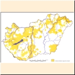
Figure 19
Areas sensitive against nitrate
The well reports, the water permits, the data of operation, the data of the basic hydrographical monitoring network can be found also at the District Water Authorities. A certain part of the data is transmitted to the Environmental Inspectorates within the framework of information-exchange between the environmental and water organizations.
The development of the Environmental Register of Groundwaters and Geological Media (Környezetvédelmi Felszín Alatti Viz- és Földtani Közeg Nyilvántartási Rendszer - FAVI) is now in progress in the environmental organization as provided by the Government Decree No. 33/2000 Korm. This contains among others information on the state of groundwaters, data on their state-requirements, on the hazardous or polluting activities and on the connected environmental measures as well. One basis of the system is the data-sheet provided by the Government Decree No. 33/2000 (III. 17.) Korm. on which information is given by the Instruction No. 8002/2000 (K.Ért.6.) of the Minister of Environment.
In order to include them into FAVI, the characteristics of activities endangering or loading the groundwaters shall be submitted to the competent environmental inspectorate using various data-sheets:
- the basic form shall be submitted by those who are going to launch activities requiring a water permit, who are running such activities and who are obliged by the Inspectorate to do so,
- the detailed form shall be submitted by those who are obliged to do so by the Inspectorate upon what was communicated in the basic form, those who are disposing more than 100 tons of hazardous substances a year if the contamination limit value (B) referring to groundwater is 1 mg/l or more and those who are disposing more than 1 ton of hazardous substances a year if the limit value (B) referring to groundwater is less than 1 mg/l
- the yearly report shall be submitted by those, obliged by the Inspectorate upon the evaluation of the basic and the detailed form by an authority decision. (The form of the yearly report is not published yet)
The data sheets of FAVI, instructions to the filling up can be found in the homepage http://www.kvvm.hu/dokumentum.php?content_id=336 of the Ministry of Environment in downloadable format.
As far as groundwaters are concerned, the information on the geological formations available at the Hungarian Geological Survey (Magyar Geológiai Szolgálat),the Geological Institute of Hungary (Magyar Állami Földtani Intézet) and at the Eötvös Loránd Geophysical Institute of Hungary (Eötvös Lorand Geofizikai Intezet) are of definitive importance. There are of special significance among them the surface geological maps, the map-series showing the geological formations of the upper 10 m, those dealing with the plain and hilly regions, the various thematic series (regional sensitivity, agrogeological, hydrogeological ones, etc.) and the data of the observation network mentioned earlier.
Informations on groundwaters are simultaneously geological data as well. The Joint Decree No. 4/1997 (11/.17.) KöM-KTM-KHVM of the Ministers of Commerce and Industry, Environmental Protection and Regional Development, and the Transport, Communication and Water Management on the groups and communication of geological data to be submitted to the Hungarian Geological Survey is relating to the organisations and mining companies carrying out geological explorations and to the geological data obtained in the course of their activities, hydrogeological explorations included.
The topsoil influences recharge and infiltration also. Data stored at the Research Institute for Soil Sciences and Agricultural Chemistry of the Hungarian Academy of Sciences (MTA TAKI) and at the Plant Protection and Soil Conservation Services are covering not only the composition of soils but also the diffuse pollution load of agricultural origin. From this point of view the TIM (Soil-information Monitoring System) must be mentioned emphatically. MTA TAKI was who developed the Agro-topographic Database (AGROTOPO) containing homogeneous agro-ecological units, covering the whole area of the country at a scale 1:100 000, further the Hungarian Digital Database on Soil Sciences and Ground-relief (HunSOTER), the latter as part of a database covering the whole of the Earth and supervised by UNEP. Beyond these the Institute possesses further extended databases containing map-series and GIS-based sets of information.
The Johann Bela National Centre of Epidemiology (Johann Bela Országos Epidemiológiai Központ) is dealing with the investigation of waters from the aspect of public health. A number of quality and bacteriological data are stored at the National Public Health and Medical Officer Service (Állami Népegészségügyi es Tisztiorvosi Szolgálat - ANTSZ).
The National Spa Head Directorate is the institution dealing with the qualification of mineral- and medicinal waters and with the registration of health resorts.
Local information on groundwater is available also at the water supply companies, at public baths and at mining companies (to a decreasing extent).
Data transmission provided by the Government Decree No. 178/1998 (XI.6.) Korm. on the provision of data connected to water management and by the Instruction No 8007/1998 (K.H.V. Ért. 24.) KHVM of the Minister of Transport, Communication and Water Management referring to the former extends to the following:
- the data exchange between the water and environmental organizations extends over the data provided by the basic networks operated by the water organs and over the data provided by the basic water quality network operated by the Environmental Inspectorates,
- the water organization publishes the data provided by the basic hydrographical network on groundwaters,
- the county institutes of ANTSZs transmit the chemical and bacteriological data of the wells operated by water supply companies and those of the samples taken by them,
- the National Geological Survey transmits the data provided by the groundwater monitoring network operated by the Geological Institute of Hungary and the results of the periodic surveys to the water organization, - the water organization transmits the data of the Well Cadastre to the National Geological Survey,
- water supply facilities producing more than 500 m 3 /d are obliged to transmit data (yield, static and dynamic levels, water temperature, produced volume, chemical analyses), to the water organization,
- above an abstraction larger than 500 m 3 /d each user is obliged to give a declaration for the determination of the water resource fee.
As a result of the present development it shall be reached in the near future that each entitled person or entity has access to any actual data on groundwaters quickly in computerized way. The processing of archive groundwater-information and the supplement thereof through expedition-like surveys have become a large-scale task of the state concerning the monitoring objectives of the EU Water Framework Directive in its surveillance phase. Supplementary exploration with boreholes is required to obtain data on the quality of the near-surface water resources, in other cases the many observation- and production wells give the possibility of surveying the various water bodies.
The Ministry of Environment issued several publications on groundwaters in the recent years (Annex 4)
|